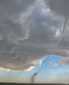
It was an active afternoon and evening of weather for much of the province Tuesday, especially west-central Saskatchewan.
Wednesday morning, Environment Canada has confirmed that three tornados touched down.
Meteorologist Dan Fulton said as far as they know all three tornados were from the same storm.
“Yeah right now it seems as though there were at least three touchdowns,” Fulton said. “Generally it looked like the area between Rosetown and Kindersley, and we’ve got reports that they all came from the same storm, they were down for a little bit,” he added.
Fulton says luckily damage appears to be minimal at this time, from what they’ve heard, it includes downed power lines and some damage to farm equipment.
Amazing video of the twister near D’Arcy! pic.twitter.com/MDyggPBcOe
— Prairie Storm Chasers (@PrairieChasers) June 16, 2021
Fulton says with more seasonal temperatures moving in across the province on Wednesday, the risk for severe weather has significantly dropped.
“There’s a cold front that is moving through and that is bringing an end to the extreme heat that’s been affecting the province, especially the western half of Saskatchewan, much more seasonable temperatures today (Wednesday) as a cold front moves through and brings brisk westerly winds,” he said.
Thunderstorm activity has shifted to east central Saskatchewan early Wednesday morning, with watches and warnings in place for the Humboldt, Melfort and Hudson Bay areas.
Fulton says that activity is expected to taper off as the day progresses.


